Posted 01/28/13
A major attraction of rural development throughout the United States is to live in relative isolation in a natural setting. However, there are costs associated with such a lifestyle with a chief concern being fire damage to property. Patricia Alexandre and Miranda Mockrin from the U.S. Forest Service use high resolution satellite imagery to map housing damage from fires in an effort to understand spatial patterns of threats and possible solutions for resource allocation and 'firewise' development.
If the opportunity were presented to live in a beautiful mountainous setting, surrounded by a natural landscape, chances are, many people would jump at this occasion. According to Patricia, ‘many of us want to live in a beautiful place and wake up with a cup of coffee viewing beautiful nature’. Yet, one problem with such ‘rural’ and ‘exurban’ development, in addition to the effects of housing development on biodiversity, is the potential threat of fires. Indeed, throughout the United States, the phenomenon of rural and exurban housing growth has increased within natural areas of public and private lands. Additionally, due to years of fire suppression, concentrated fuel loads have created conditions leading to higher frequency and intensity of fires. As a result, rural and exurban housing developments are at risk, which causes direct threats to lives as well as huge costs of fire fighting and prevention (Figure 1).
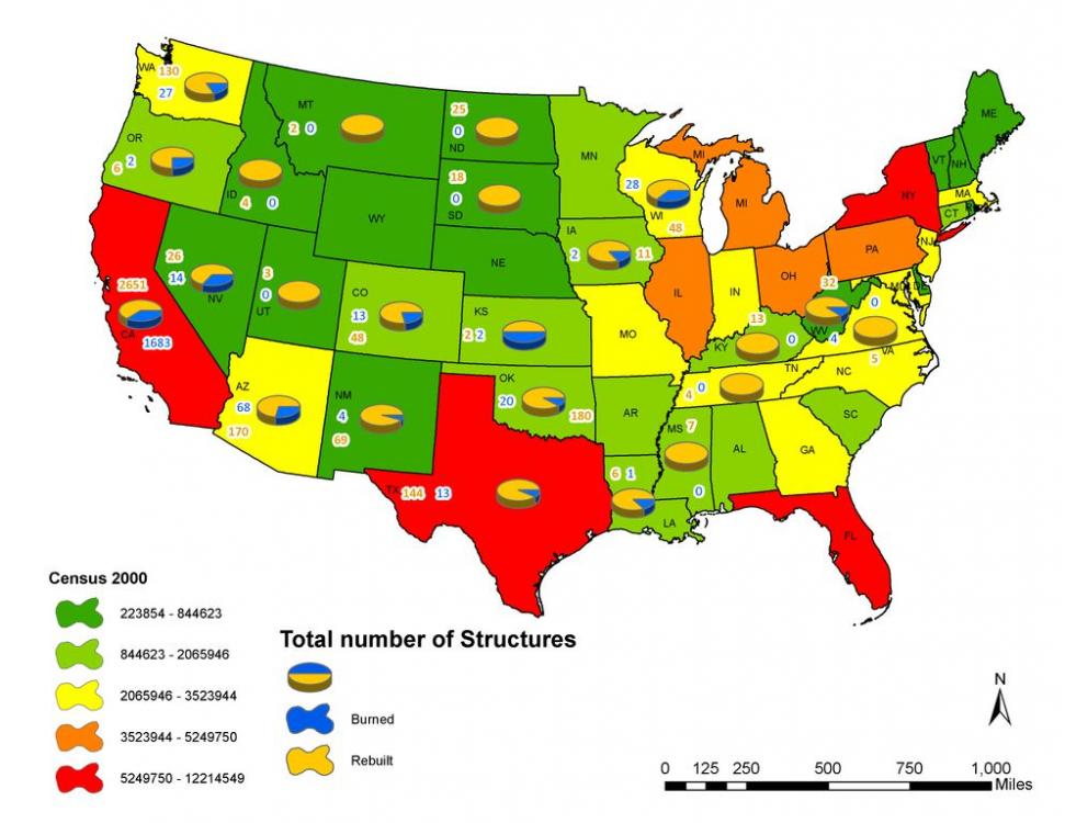
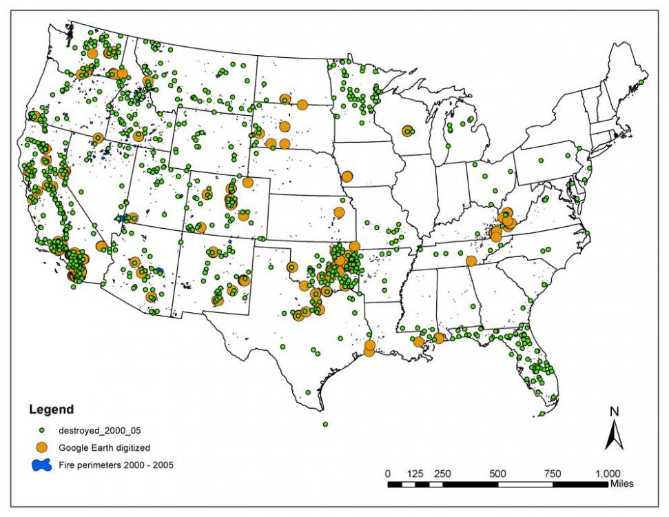
Patricia Alexandre from UW-Madison, Miranda Mockrin from the US Forest Service, and a team of undergraduate researchers are investigating where fires are destroying homes throughout the United States using hand digitization with Google Map imagery, within all the fire perimeters from the Monitoring Trends of Burn Severity (MTBS) dataset that occurred between 2000 and 2005. The main goal of their project is to understand the spatial component of houses lost to fires as well as rebuilding efforts. Patricia wonders if the effects of fires on rural and exurban housing developments in one location of the country are similar in another location. The desired outcome from her work is to better allocate resources used for 1) fighting and preventing fires, and 2) protect homeowners from disastrous effects of fires.
The outcomes of Patricia’s and Miranda’s work are targeted at federal, state, and private land managers as well as rural homeowners. Because the spatial component of her work is critical to understanding trends of housing loss to wildfires and rebuilding efforts, she hopes to provide maps informing preventative fire policy. Surely, these are results those of us hoping to one day live in a beautiful setting surrounding by nature can truly value.”
Story by Eric Wood