Posted 01/16/14
Catalina is leading an international collaboration that is using old military land cover surveys from the 19th century, combined with more recent maps and satellite images, to determine how past land use effects subsequent land cover changes.
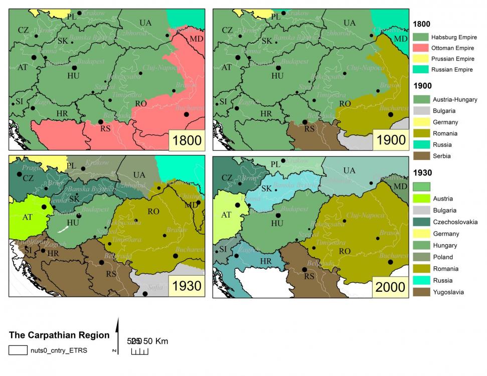
Historical maps are often displayed for their beauty, but Catalina Munteanu uses them for more scientific purposes. Catalina is leading an international collaboration studying the effects of past land use on subsequent land-cover changes in the Carpathian Mountains. Though it is thought to be important, such legacy effects of land use can be difficult to study because long-term, spatially detailed records of land use are rare. However, starting with the Austro-Hungarian and Ottoman empires in the 19th century, spatially detailed surveys of land-cover have frequently been conducted to improve national defense in this oft-contested region of Eastern Europe. But bringing this information to the digital age can be a challenge.
In most cases, historical (paper) maps are scanned, georeferenced, and features are manually converted to digital form. This works well for small study areas, but is not feasible for the 400,000 km2 Carpathian Region. To answer the large-scale spatial questions they are interested in, Catalina and her fellow researchers instead covered the study area with a 2 km grid of points (>100,000 points!) and digitized land cover at each of these points for the entire timespan, including satellite imagery for more recent times. Land cover categories included agriculture, grassland, wetland, and urban development.
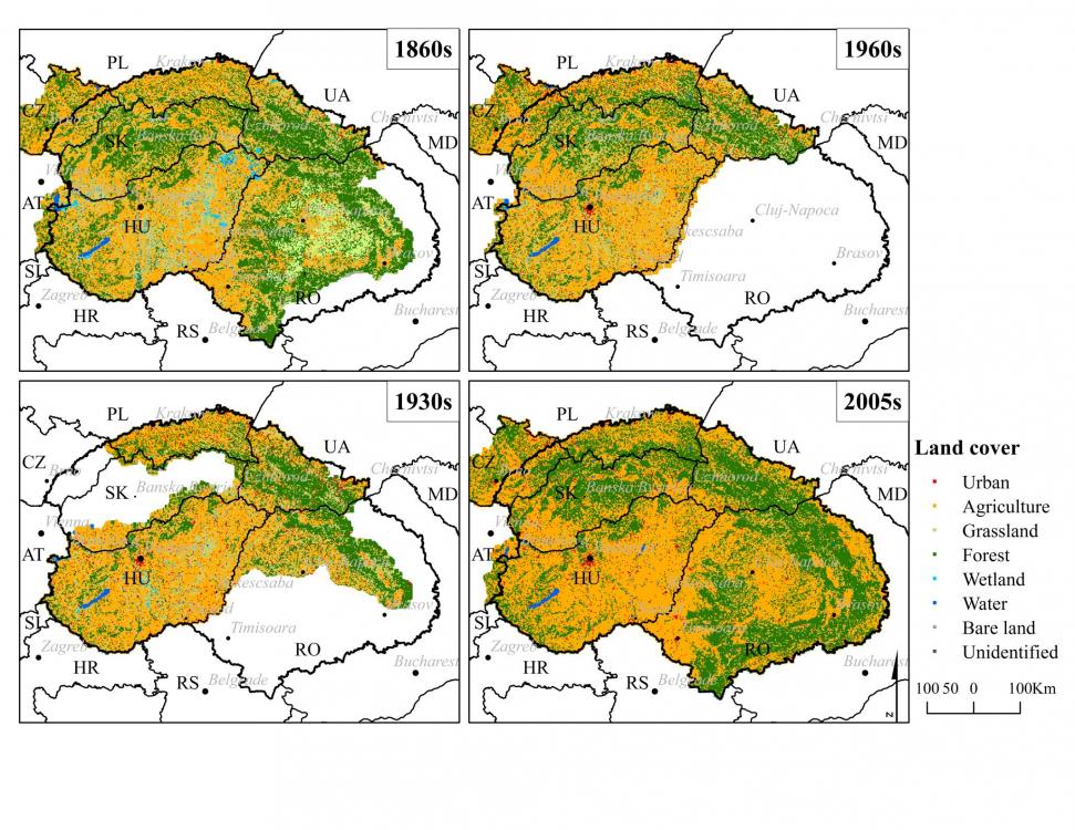
So far, this study has shown that both agricultural and grassland area increased in the Carpathian mountains peaked prior to World War II, and since then forest cover as increased as agricultural land was abandoned. This study has also quantified a severe decline in wetland area through the entire study period, a finding that had only been shown at small spatial and shorter time scales in the past. In addition to determining legacy effects of past land use, Catalina is also interested in how in how political and socioeconomic transitions may affect land cover. The Carpathian Region has undergone many such transitions since the 19th, making this dataset a good resource for this avenue of future research.”
Story by Andrew Allstadt