Posted 08/3/11
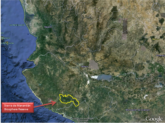
Sierra de Manantlan is a biosphere reserve in the western Mexico within the states of Jalisco and Colima. Established in 1987, the reserve is a complex patchwork of old growth remnants and regenerated forest following extensive logging. The reserve also contains a human population of approximately 30,000 residents that farm within portions of the reserve. Dr. Oscar Cardenas is studying the evolution of forest patterns over the last 25 years using satellite imagery analysis to identify areas of forest regeneration and deforestation. Preliminary results have identified areas in the southern portion of the reserve as the most impacted by adjacent human communities. Dr. Cardenas hopes that future analyses will target management efforts by the reserve's administration, update use zone designations within the reserve, inform the potential for disease outbreaks and help identify areas important for the dispersal of target species such as the enigmatic Jaguar.

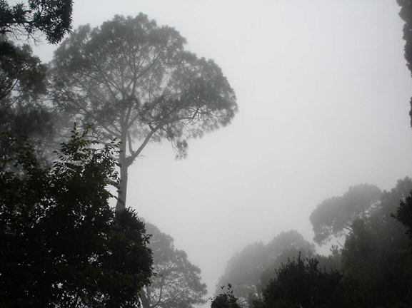
Sometimes all it takes to find enchantment is a walk in the woods. Dr. Oscar Cardenas found enchantment nearly two decades ago while hiking through the Sierra de Manantlan biosphere reserve. He and his party had hiked up an old road into the reserve, got a little turned around and wound up having to hike out overnight. Cardenas describes the combination of the forest at night and the interplay of moonlight in the mists as simply ‘magical.’ A professor at the Universidad de Guadalajara-Autlan, Dr. Cardenas began formally studying the reserve over a decade ago. ‘At first I wanted to study the wildlife of the area’, he says, ‘but I quickly realized that in order to understand how wildlife uses the area I needed to understand their habitats and how human uses affect those habitats.’ It is a goal that requires in-depth knowledge of the reserve’s ecology, the needs of its 30,000 human residents and their history.Sierra de Manantlan was dominated by old-growth forest into the 1940s when it attracted the attention of international logging companies. By the middle of the 1980s the area was almost completely cut over, save for the few areas that loggers could not reach due to steep terrain. This created widespread ecological problems as well as social unrest. In 1987, Mexico’s federal government delineated the

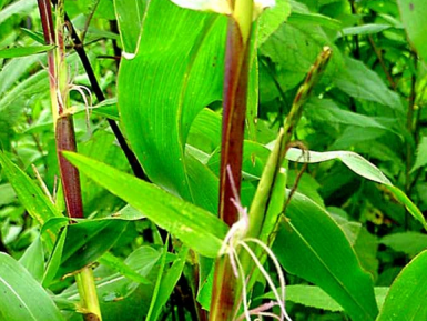
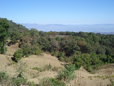
boundaries of the biosphere reserve with the goal of conserving the remaining biodiversity of Manantlan as well as ensuring the ability of local residents to access portions of the reserve for farming and other income generation. The protection has not been in vain: the combination of a quickly regenerating forest, remnant old growth sites, and small-scale agriculture has resulted in a landscape with a great deal of complexity. This complexity leads to a wide variety of habitat types usable to a range of flora and fauna: the reserve is home to seven different vegetation zones with over 3,000 species of vascular plants, nearly 400 bird, and approximately 300 mammal species. Among these are such notables as Wild Maize (Zea diploperennis), an ancestor of modern corn, Mountain Trogon (Trogon mexicanus) and the Jaguar (Panthera onca).It takes a pretty broad perspective to map and monitor change patterns within a reserve that is approximately 140,000 hectares (approximately 346,000 acres). It takes a satellite’s perspective, actually. By using satellite images taken every five years from 1986-2011, Dr. Cardenas can identify the landscape changes that he is most interested in: where forest has recovered during that time and areas where has it been lost. From his initial results, the biggest contributors to deforestation in Manantlan are forest fires, intensive livestock grazing and the spread of industrialized agriculture practices, which require large-scale clearing of wooded areas. These deforestation pressures appear concentrated in the southwestern portion of the reserve, and coincide with the highest human population centers in and around Manantlan’s territory. Dr. Cardenas is excited that with further analyses he can provide a more complete picture about the change patterns within Manantlan’s forests since the reserve’s establishment.

Specifically, Dr. Cardenas hopes that quantifying the patterns of landscape changes in and around Manantlan will give the reserve’s managers the tools to better delineate different use zones (i.e., buffer, transition, and core) within the reserve. Manantlan’s logging history and current agricultural uses make it a land in transition. Identifying areas of heavily regenerating forest may lead to new core zone designation. Areas that show deforestation can target sustainable development programs for local communities and focus management efforts for the reserve’s administration. Dr. Cardenas is not content to simply identify where change is occurring within Manantlan, however. Future work will build on these efforts to inform projects such as modeling species distributions within the reserve, identifying broader conservation priorities outside of the reserve’s boundaries and indicating where potential outbreaks of zoonotic diseases may occur. All of these efforts came from a random walk in the misty moonlight on a nameless road in Manantlan’s forests. Over twenty years ago, Oscar Cardenas realized the magic that Manantlan contained and embarked on a journey to better understand it. Through that understanding he hopes to build tools to help protect it and ensure that others can experience it for themselves. Perhaps it is not hard to imagine magic in the tropical forests of Manantlan, where Jaguars roam and cloud forests transition to oak-pine complex. This is the home of Carlos Santana, after all. Perhaps magic is just another part of the landscape. style=”text-align:”>

“
Story by James Burnham
