Posted 01/17/19
Johanna conducts research on land use change in areas of political instability. She focuses on the Caucasus region, an area that has experienced the fall of the Soviet Union and armed conflicts. Johanna analyzed Landsat imagery from 1987 to 2015 looking for forest clearing and cropland abandonment. Surprisingly, she found that the Caucuses has not experienced as much loss of arable land and forests as other former Soviet areas. She explains that the forests in the Caucasus might be too remote for large clearings, and the farms probably continued to produce if they were far from loci of conflicts. Her work illustrates the need for understanding local contexts in interpreting patterns of land use change.
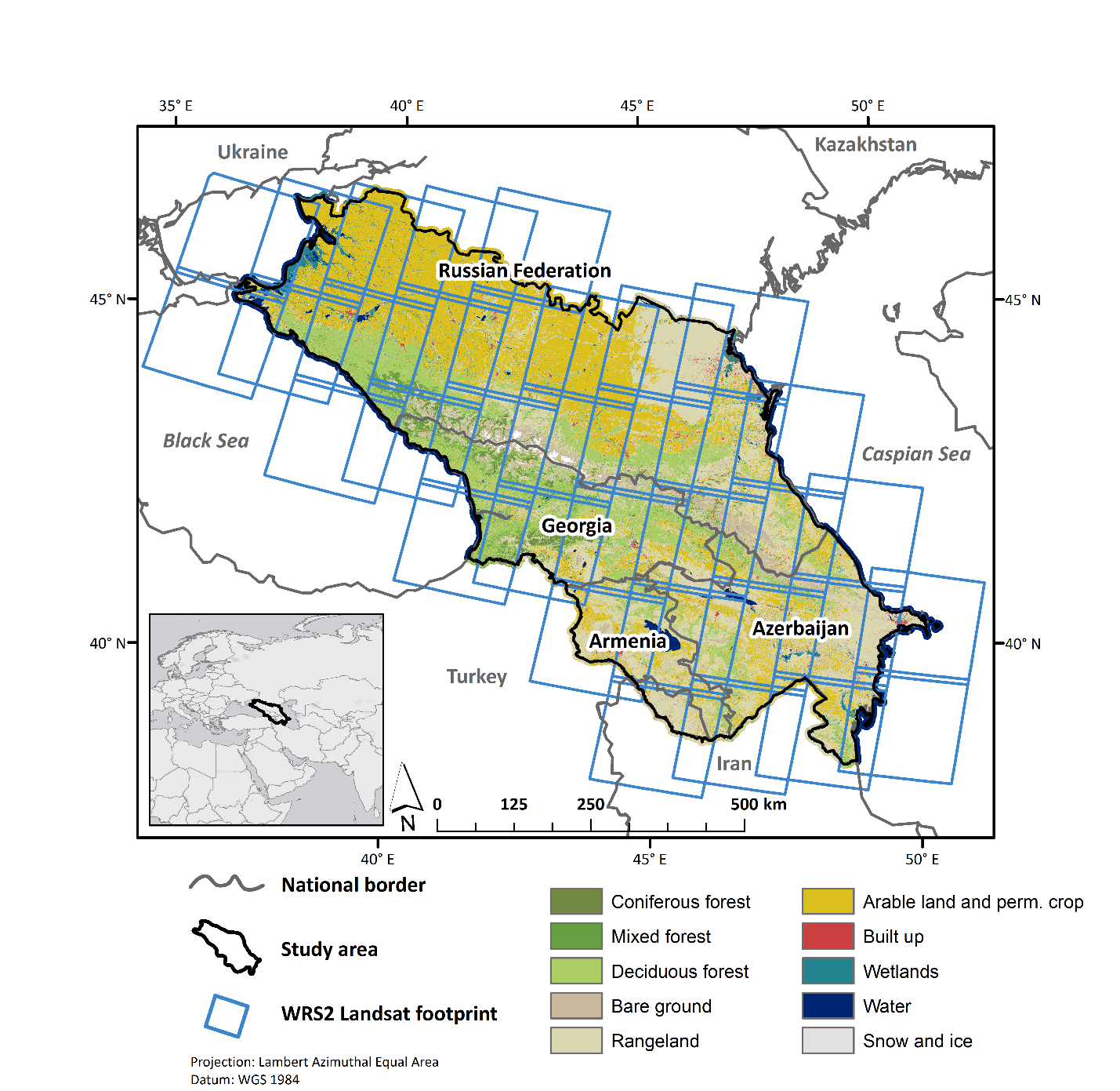
The Caucuses region (encompassing parts of Russia, Georgia, Armenia and Azerbaijan) has experienced extreme political upheavals. The collapse of the Soviet Union meant that the four countries became sovereign. Their powerful neighbors — Russia, Iran and Turkey – maintained strong geopolitical interests in the newly independent nations of Georgia, Armenia and Azerbaijan. As a result, the Caucasus has experienced four armed conflicts since 1991. In light of such extreme social and political disruption, Johanna wanted to know how cropland and forests had changed.
From previous research, some by former SILVIS lab members Drs. Mihai Nita and Catalina Munteanu, we know that some areas in Eastern Europe saw rapid cropland abandonment after the USSR collapsed. Other areas experienced forest clearing during the soviet era, and forest regrowth afterwards. Why do countries that are ostensibly similar geopolitically show such a wide range of land use outcomes?
“I want to make a clear link between land use and socio-political changes, but to do that you first have to describe where and when the land use changes have taken place.” Johanna says. To do that, she used Landsat imagery from 1987 to 2015 and mapped changes in land use and land cover.
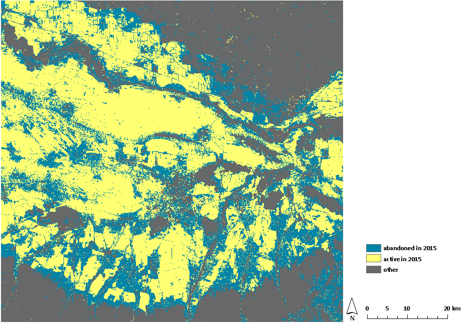
Johanna found that there was some cropland abandonment in the Caucasus, particularly during the transition period in the 1990s and the time of armed conflicts. However, the cropland abandonment rate is far lower than the one apparent in eastern European countries that also experienced the breakdown of the Soviet Union. She has also found that forest as stayed surprisingly steady during the study period in the Caucasus.
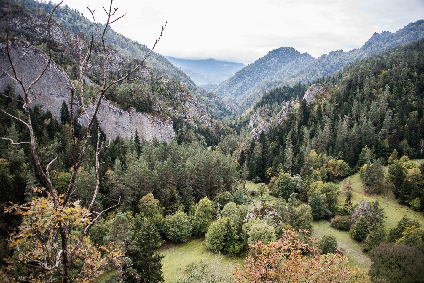
Her findings are rather surprising, since we expect political instability to interfere with cropland, and to make forests vulnerable for illegal harvesting. But in the Caucasus, Johanna explains, the steep, inaccessible terrain may have protected the forests from large clear cuts; even though the extracting of single valuable trees is widespread. Cropland, on the other hand is related to demand for food: cultivation continued wherever possible, unless we find armed conflicts in the region.
“What I can say is that land use patterns and outcomes are extremely dependent on the local context, especially in such a diverse region like the Caucasus” Johanna cautioned.
Indeed.
Story by Kimambo, Niwaeli