Posted 02/8/21
Currently, there are few land cover maps for the mid-20th century. To fill this knowledge gap, Afag is producing highly detailed land cover maps for the diverse Caucasus eco-region by utilizing imagery from former spy satellites, object-based classification, and the Google Earth Engine platform. The methods for creating these maps can be applied globally by land managers and policymakers to evaluate how past land cover policies have affected the current landscape.
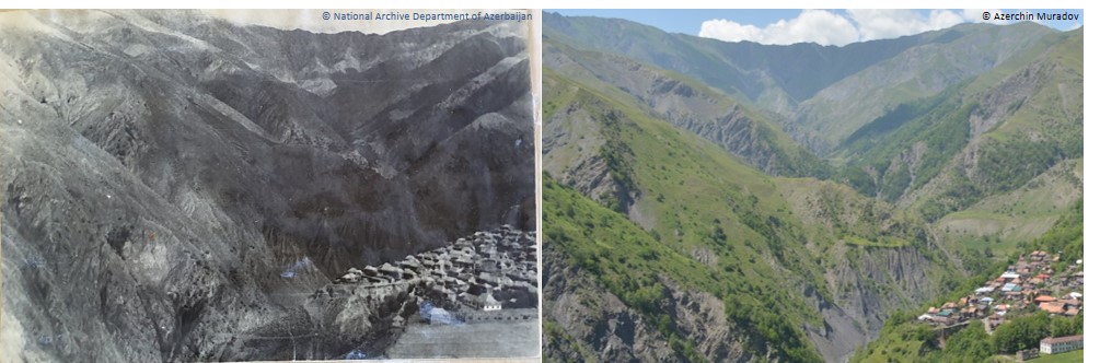
Humans have altered natural landscapes for millennia, but especially so in recent decades. Recognizing how landscapes have changed over time is critical to understanding the relationship between humans and their environment. In studying this relationship, detailed land cover maps are a key resource. However, to date, there are few detailed land cover maps for the mid-20th century due to of the minimal amount of spatial data available during this time. Afag is developing a novel approach to detailed land cover mapping that will provide more context to mid-20th century landscape changes. Her final maps will incorporate land cover classes such as forest, grassland, agricultural land, water, and urban area.
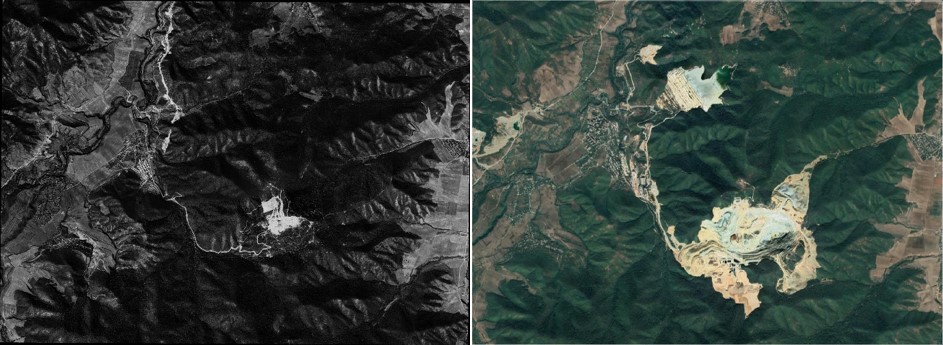
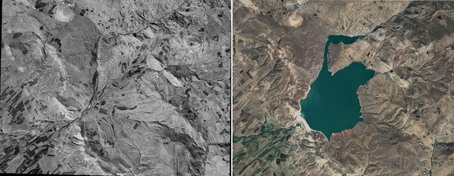
Afag is working on a methodology that will automatically map land cover maps anywhere on the globe from high resolution black and white imagery captured by Corona satellites, i.e., former US spy satellites. Afag is testing her methodology in the Caucasus eco-region encompassing the countries of Azerbaijan, Russia, Georgia, and Armenia, which has diverse ecosystem. This region has areas of extreme elevation and unique biomes. That means that if her methods work in this very diverse region, they should be applicable anywhere. Afag is using object-based image analysis to extract important land use information from satellite data. The classifications are conducted in Google Earth Engine and results in detailed land cover maps.
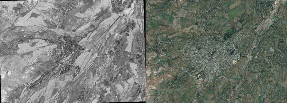
Land cover maps are a valuable for both scientists and land managers. They provide means to evaluate how past land use decisions have affected the current land cover. The maps may also be helpful for projecting future land use changes. Additionally, land use maps can assist in identifying the scale at which politics and wars affect the landscape over time. Ultimately, Afag’s methodology will have the capability to automatically map mid-20th century land cover in large areas across the globe. Her research will help solve tough questions relating to landscape changes over the last half-century.
Story by Kasraee, Neda