Posted 04/13/21
Detailed maps can be crucial for many applications. However, the larger the study area the more challenging it is to make detailed maps. I am testing different combinations of mapping techniques to improve land cover / abandonment maps of the Eurasian steppes so they are most suitable for biological research.
Maps are a key instrument and important data source for a wide range of research from global modeling to detailed ecological studies of a specific species. However different scales of tasks require proper instruments including a suitable maps detalization. For instance, a scientist who is interested in the general trends of agriculture abandonment may not have to pay too much attention to which specific fields are not in use anymore. However, for a conservation biologist studying a rare species, detailed maps of habitats, such as abandoned crops, is critical. However, it is difficult to make such detailed maps for large areas. Global maps are many, but they lack necessary details, while fine-scale maps only cover small areas if they exist at all. Unfortunately, using inappropriate scale of the input information either makes the results too general to be sensible or leads to incorrect conclusions.
In practical terms, precise mapping is a matter of balance of time and efforts versus the desired quality of results. The more accurate is a map the more resources are required to make it. But the amount of the resources necessary for creating a good map for a large area may be beyond what project managers can afford.
Coming back to the abandonment and land cover mapping, the maps are important for a variety of tasks including economic (re)development, nature conservation, and agriculture improvements. Thus, the absence of proper maps could make ecological and economic problems even worse.
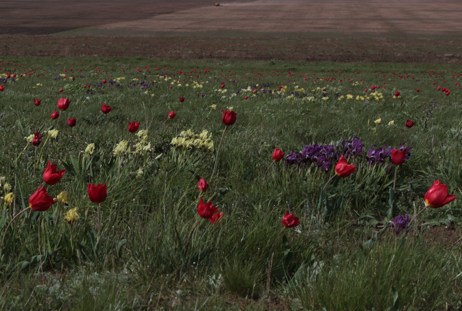
Part of my research is about the level of accuracy we could (or should) achieve when mapping large areas. I have chosen the Eurasian Steppe as a test site because it is vast, large areas of abandonment, as well as permanently used field,) and rich diversity of natural vegetation. At the same time, it is one of the most transformed landscapes in Eurasia where biodiversity conservation and preserving intact steppes as the source of both rare and dominant native species to re-habit the man-made vacuum is a top priority. What makes the mapping of these areas challenging though is that the natural vegetation, mainly grasses and herbs, is spectrally very similarly to agriculture in satellite images.
I am planning to test several mapping techniques taking into account the advantages of each and adjust them to specific conditions of the steppe. The random forest algorithm is easy and fast enough to make initial maps. These maps show general land cover of an area and allow to reveal sources of mismapping. The segmentation algorithm is helpful in drawing more clear borders but fails to distinguish objects that have similar reflection while belonging to different classes. The understanding of general structure gained from the initial maps gives better reasons to divide a large heterogeneous area into smaller and more solid parts where differences between the mapping classes are higher than in-class variability. Ultimately, I hope to achieve two results. The first is understanding of how to combine existing methods to improve the whole map quality. The second is to create maps suitable for ecological research, preserving biodiversity and the establishment of new protected areas.
Story by Rogova, Natalia