Posted 02/8/21
Are Dynamic Habitat Indices with medium resolution useful to assess biodiversity and species abundance pattern? PhD student Elena Razenkova with support group of researchers is exploring this question.
Human activity cause major changes to the planet and biodiversity is declining at an alarming rates. In order to prevent biodiversity loss, conservation actions require to assess current status of biodiversity to better understand and predict future changes, to identify the major drivers of biodiversity patterns, and to map biodiversity patterns. However, monitoring biodiversity over large areas is challenging to do in the field. Remote sensing provides the opportunity to develop indices that are designed for biodiversity assessment, because satellite data are collected systematically across broad scales. Vegetation productivity is one of the important determinants of species richness and density across broad scale. Vegetation indices derived from satellite data are a good proxy for vegetation productivity over broad areas. The Dynamic Habitat Indices (DHIs) summarize the three different aspects of vegetation productivity: cumulative productivity, minimum productivity, and seasonality in the way that it became relevant for biodiversity (Hobi et al., 2017; Radeloff et al., 2019; Razenkova et al., 2020). However, so far the DHIs have only been derived from coarse-resolution satellite imagery, which limits their value for management decisions.
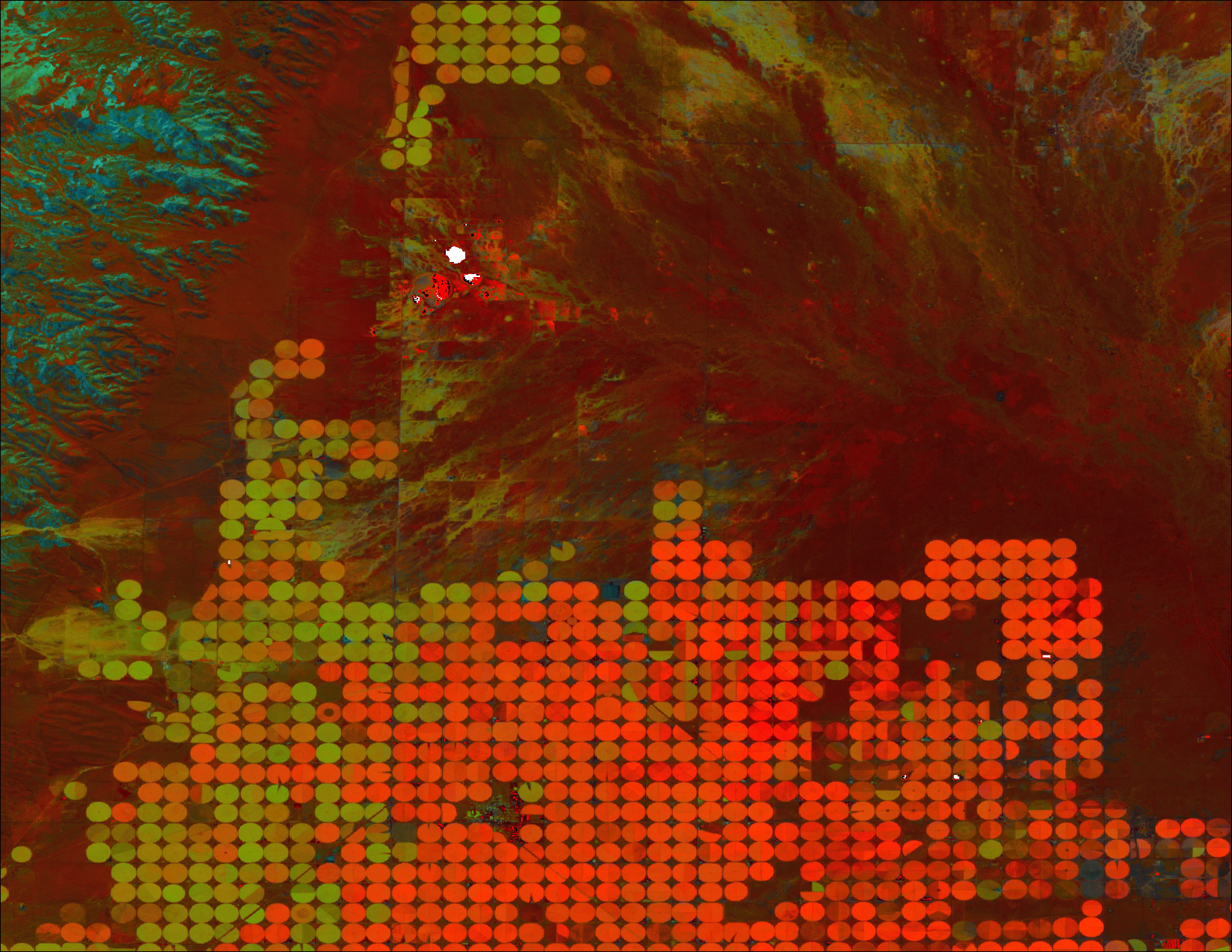
Our goal is to develop the DHIs using medium-resolution Landsat imagery for monitoring biodiversity and abundance pattern across the conterminous United States. The main advantage is that imagery with medium resolution provides more detailed information about the spatial patterns of productivity. Our rationale was that the DHIs with higher spatial resolution could capture the difference in vertical structure of vegetation and characterize habitat heterogeneity at much finer scale, especially in complex mountainous terrain and areas with fragmented land cover. Having this crucial information in my hand, will help to understand how species respond to anthropogenic modification of landscapes, which disturb the integrity of landscape pattern. However, the temporal resolution of Landsat is low, and that creates a lot of challenges for the calculation of the DHIs.
We will develop the DHIs for the conterminous United States and test the usefulness of the DHIs for explaining the avian species richness and abundance pattern. Our study covers a wide range of ecoregions, and has diverse climatic zones and topography, resulting in a large number of habitats and large ranges of the DHIs. Moreover, rich datasets for bird richness and abundance are available for the US, particularly the western US. Our research will add more understanding to the importance of higher spatial resolution for characterizing the DHIs metrics and consequently for modeling biodiversity and individual species pattern. Moreover, our work will add more knowledge about drivers of avian diversity across broad spatial extents that can be used to predict how biodiversity patterns will change in the future depending on changes in vegetation productivity.
Story by Elena Razenkova