Posted 02/8/21
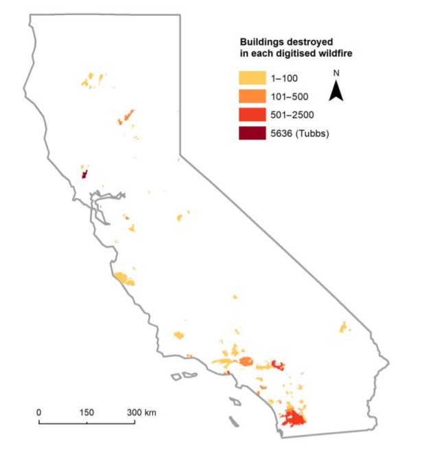
Increased climate change and growing housing density, specifically in highly populated California, may result in increased wildfire risk to houses. We can see the effects of increased housing near wilderness areas today. However, looking back an additional 50 years and studying the history of this change provides further insight into this issue. Understanding housing density growth could help save human lives, houses, and money. Neda Kasraee is working on identifying historical housing trends and patterns in areas that are under high exposure to wildfires.
The wildland-urban interface (WUI), the area where houses and wildland vegetation mix or intermingle, is rapidly growing. Housing expansion into the WUI has increased wildfire frequency and risk. This is in part because human-caused wildfires are responsible for most of the wildfires in the WUI. The rising intensity and frequency of wildfires have led to increased damage and loss of life in recent years. Because wildfire risk increases when people live near or in the WUI, it is beneficial to study historical housing trends and urbanization in these areas.
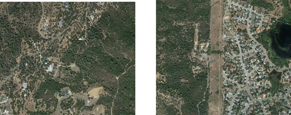
Globally, more frequent wildfires have become the new normal, and it is important to understand if and how housing development has worsened the damage. To find answers, Neda is using historic and current high-resolution satellite imagery to map housing units in California over the past 50 years. Neda plans to evaluate housing growth from the 1970s to the present-day to evaluate if there has been a proportional increase or decrease of houses in California in the WUI.
Neda’s main objective is to identify the areas of increased housing in the WUI and, ultimately, find out whether these areas have adapted to potential risks caused by wildfires. The main idea is to provide insight into how humans have adapted to wildfires over the past 50 years. Researching whether policy and communities adjust where houses are built based on wildfire risk could provide insight into the extent of WUI growth.
With thoughtful housing choices, there could be substantial benefits to the environment, as well as saving human lives, money, houses, and wild animals. Since it is always wise to “learn from our own mistakes,” it is important to understand which choices in the 20th century have caused additional wildfire risk. Stay tuned and follow Neda’s work for insight into thoughtful housing choices in California.
Story by Radeloff, Volker