Feb 2021
- Remote Sensing
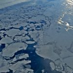
Global climate change represents a grave threat to the majority of the Earth’s ecosystems. This is especially true for the Polar Regions, which will experience the largest rises in temperature within the coming century.
Feb 2021
- Biodiversity
- Conservation
- Remote Sensing
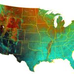
To better understand avian species richness and abundance, Elena Razenkova is developing Dynamic Habitat Indices from Landsat data.
Feb 2021
- Houses & WUI
- Remote Sensing
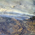
To assess the effects of exurban development in California, Neda Kasraee is exploring the long-term changes in housing density in areas under high wildfire threat.
Feb 2021
- Land Use
- Remote Sensing
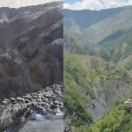
Developing methods for detailed land cover mapping to assess more than half-a-century of change.
Jan 2021
- Biodiversity
- Conservation
- Remote Sensing
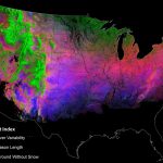
David Gudex-Cross and Likai Zhu are developing new satellite-based indices of snow and frozen ground dynamics for winter biodiversity assessments and other conservation applications.