Jan 2013
- Conservation
- Remote Sensing
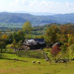
Not knowing how land has been used in the past makes it difficult to understand how it is being used now and even more difficult to predict how it will be used in the future, especially in regions with multiple socio-economic shocks, such aslike the Carpathian Basin. Our team is working on that.
Aug 2011
- Biodiversity
- Conservation
- Land Use
- Remote Sensing
Dr. Oscar Cardenas is working to better understand patterns of forest change in the Sierra de Manantlan Biosphere Reserve to develop more effective management tools addressing a range of issues from biodiversity conservation to sustainable development programs and epidemiological applications.
Aug 2011
- Remote Sensing
The breakdown of the Soviet Union in 1991 triggered rapid and widespread farmland abandonment across Eastern Europe. Using remote sensing and statistical models, Matthias Baumann mapped where abandonment occurred in Ukraine and explained why it happened where it did.
Aug 2011
- Biodiversity
- Conservation
- Land Use
- Remote Sensing
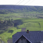
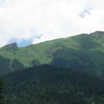
Jodi Brandt studies mountain ecosystem succession in China. This loss of alpine pastures affects both people and biodiversity. Which factors are responsible for these changes?
Jul 2011
- Biodiversity
- Conservation
- Land Use
- Remote Sensing
Eugenia Bragina has started an exciting new project to understand land cover changes in and around nature reserves in Russia, and how these changes affect wildlife populations.
Jul 2011
- Biodiversity
- Remote Sensing
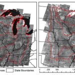
There is not a map that predicts bird species biodiversity for the whole United States at scales that are relevant for a forester or a county planner. However, such a map is utterly needed to make realistic conservation plans.
Jul 2011
- Conservation
- Land Use
- Remote Sensing
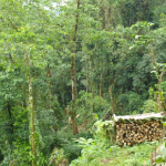
If poverty leads to deforestation in Mexico, can we prevent deforestation by paying landowners to sustainably manage forest? Carlos Ramirez Reyes is trying to answer this question using remotely sensed data.
Nov 2010
- Biodiversity
- Conservation
- Land Use
- Remote Sensing
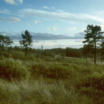
Sarah Carter has been working on Wisconsin conservation issues for more than 10 years. Her current project asks how we can identify conservation priorities in some of Wisconsin’s most treasured landscapes, including the Baraboo Hills and the Northwest Wisconsin pine barrens.
Sep 2010
- Biodiversity
- Conservation
- Remote Sensing
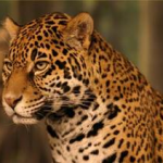
Oscar Cardenas, an invited scientist in the SILVIS Lab, is working on the zoning of a biosphere reserve in Mexico where he studying jaguar habitat in order to assure the species presence for the future. While doing so, he’s faced with social issues that are intrinsically and deeply related with natural resources protection and preservation and raise some new research questions.
Aug 2010
- Conservation
- Land Use
- Remote Sensing
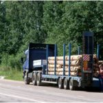
After the collapse of the Soviet Union in 1991, privatization of timber firms was expected to provide an efficient mechanism for the management of forest resources in Russia. Kelly Wendland analyzes how economic factors have impacted harvesting since transition and explores whether weak governance effected investment decisions in European Russia.