Feb 2013
- Conservation
- Houses & WUI
- Land Use
Research topics range from economics to entomology, and research locations literally span the globe. Some might call administering such a grant challenging, but to Shelley Maxted, it’s a treat.
Feb 2013
- Biodiversity
- Conservation
- Land Use
Sebastian Martinuzzi investigates how future land use changes in the United States could impact the Nation’s areas of biodiversity significance, with help from economic-based scenarios
Feb 2013
- Biodiversity
- Conservation
- Houses & WUI
- Land Use
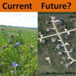
Sarah Carter uses projections of future housing development to identify those sites requiring immediate conservation attention in order to successfully conserve Wisconsin’s biodiversity.
Feb 2013
- Conservation
- Land Use
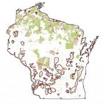
Identifying potential sites for the successful reintroduction of a species is difficult. Post-doc Steve Wangen applies an agent-based method to the reintroduction of the American marten into northern Wisconsin.
Jan 2013
- Conservation
- Land Use
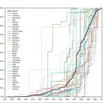
When it comes to creating protected areas for conservation, ecologists tend to focus on the where. However, to establish new protected areas, the question of when may be just as important.
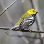
Jan 2013
- Biodiversity
- Birds
- Conservation
- Houses & WUI
- Land Use
Locations in and around natural areas are especially appealing for housing development. Unfortunately, this development may have undesirable consequences.
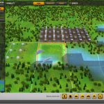
Jan 2013
- Conservation
- Land Use
What if someone told you that you could be of great help to science in general and conservation in particular and have fun at the same time? Forward Trails is a Massive Multiplayer Online Game that allows you to do just that!
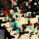
Jan 2013
- Birds
- Conservation
- Fire
- Houses & WUI
- Land Use
Dave Helmers sits down with me and gives the skinny on how he turns U.S. Census data into ecologically relevant products for answering some of the most pressing questions in land-change conservation science.
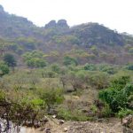
Jan 2013
- Conservation
- Land Use
- Remote Sensing
Carlos Ramirez Reyes develops a way to monitor deforestation in Mexico using satellite images from 1990 to present.
Jan 2013
- Biodiversity
- Land Use
The availability of multitemporal, dense time series of Landsat imagery opens new possibilities for tracking forest dynamics in areas of complex landcover in Europe