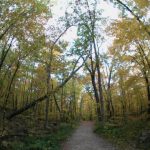
Jan 2016
- Land Use
- Remote Sensing
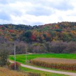
The economic, ecosystem service, and recreational value of forests depends on their tree composition. Konrad Turlej’s goal is to map how widespread different tree species are.
Jan 2015
- Biodiversity
- Conservation
- Land Use
- Remote Sensing
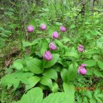
In central Siberia, old growth forests are threatened by illegal logging. Finding these sites by foot is an overwhelming task, and researchers turn to the skies, using satellites, in their conservation efforts.
Jan 2015
- Fire
- Houses & WUI
- Land Use
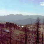
A study lead by Patricia Alexander is trying to identify the factors that determine the likelihood of house loss given a wildfire.
Apr 2014
- Conservation
- Land Use
- Remote Sensing
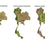
Biodiversity is being lost at an alarming rate, often due to habitat degradation and loss. To help optimize conservation planning and monitoring, Naparat Suttidate has developing and testing an easy method to predict biodiversity in Thailand based on remote sensing data.
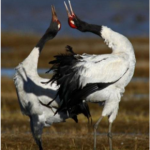
Mar 2014
- Biodiversity
- Birds
- Conservation
- Land Use
- Remote Sensing
After a period of increase, Black-necked Cranes have been in decline at Napahai wetland since 2000. These patterns appear linked to the growth of the nearby city of Shangri-La.
Mar 2014
- Birds
- Conservation
- Land Use
We might be loving our wildlife habitat to death. Research by Max Henschell, a PhD student, has found that recreational enjoyment of protected areas may be impacting birds.
Jan 2014
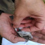
- Biodiversity
- Birds
- Land Use
Paul Schilke, MS candidate in the SILVIS Lab, is conducting research in northern Wisconsin to investigate how insects that live around lakes affect the birds that feed on those insects.
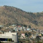
Jan 2014
- Biodiversity
- Conservation
- Land Use
- Remote Sensing
Forests of Mexico are under threat due to development, both for urban and agricultural purposes. However, it is not clear the spatial and temporal extent to which this is happening. SILVIS PhD candidate, Carlos Ramirez Reyes is exploring this using remote sensing data, and a novel method, spectral mixture analysis.
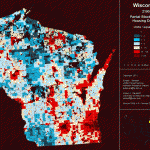
Jan 2014
- Land Use
Information about housing densities at fine spatial scales is critical to understanding how human development impacts wildlife. Nick Keuler, statistician for the SILVIS lab, and Roger Hammer at Oregon State University are using Bayesian statistics to project US census data to smaller spatial scales.
Apr 2013
- Conservation
- Land Use
- Remote Sensing
Satellite imagery provides invaluable information regarding land cover features over time. However, since many satellite-based image sensors cannot see through clouds, imagery researchers need to screen cloudy pixels from cloud-free pixels in order to analyze land change through time.