Nov 2010
- Biodiversity
- Conservation
- Land Use
- Remote Sensing
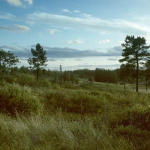
Sarah Carter has been working on Wisconsin conservation issues for more than 10 years. Her current project asks how we can identify conservation priorities in some of Wisconsin’s most treasured landscapes, including the Baraboo Hills and the Northwest Wisconsin pine barrens.
Nov 2010
- Conservation
- Houses & WUI
- Land Use
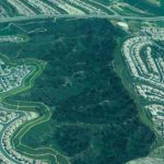
Could land use change threaten the US National Wildlife Refuge System? PhD student Chris Hamilton uses cutting-edge technologies to find an answer.
Sep 2010
- Biodiversity
- Conservation
- Remote Sensing
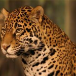
Oscar Cardenas, an invited scientist in the SILVIS Lab, is working on the zoning of a biosphere reserve in Mexico where he studying jaguar habitat in order to assure the species presence for the future. While doing so, he’s faced with social issues that are intrinsically and deeply related with natural resources protection and preservation and raise some new research questions.
Aug 2010
- Birds
- Conservation
- Land Use
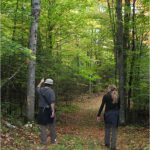
If you build it, they will come is a cliche, to say the least. In the context of parks, recreation trails, and conservation of biodiversity, Marty Pfeiffer offers a new twist on the old cliche: If they come, can you still conserve biodiversity?
Aug 2010
- Conservation
- Land Use
- Remote Sensing
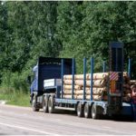
After the collapse of the Soviet Union in 1991, privatization of timber firms was expected to provide an efficient mechanism for the management of forest resources in Russia. Kelly Wendland analyzes how economic factors have impacted harvesting since transition and explores whether weak governance effected investment decisions in European Russia.
Aug 2010
- Birds
- Conservation
- Land Use
Trends in land use, and in turn wildlife habitat loss, are closely interlinked with economics. Predicting forest bird diversity under different simulated land use scenarios, including both ecological and economic parameters, improves our understanding of the effects and drivers of habitat loss.
Aug 2010
- Biodiversity
- Birds
- Conservation
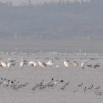
Poyang Lake, one of China’s most diverse wildlife areas, increasingly faces shifting use patterns and new threats to the wildlife and human communities who call it home. Ph.D. candidate James Burnham seeks to understand how changing lake hydro-dynamics and human impacts affect the local wildlife, particularly the critically endangered Siberian Crane.
Aug 2010
- Conservation
- Remote Sensing
Alexander Prishchepov is looking at region in Eastern Europe that allows constructing and testing hypothesis about land use changes in a transition from command to market economy.
Aug 2010
- Conservation
- Remote Sensing
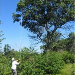
Vegetation structure is an important habitat attribute characterizing bird habitat. Measuring vegetation structure in the field is time consuming and thus inefficient across large scales. Eric Wood is exploring whether use of a metric called image texture derived from satellite and aerial images can potentially streamline the process of assessing vegetation structure and facilitate prediction of bird distribution across large areas.
Jul 2010
- Conservation
Dave Helmers and collaborators are using Open Source software tools in an NSF funded study predicting future land use change across the U.S.