University of Wisconsin–Madison
SILVIS LAB
Spatial Analysis For Conservation and Sustainability
  • HOME
  • PEOPLE Expand Collapse
    • Current Members
    • Alumni
  • RESEARCH Expand Collapse
    • Overview
    • Biodiversity
    • Birds
    • Conservation
    • Fire
    • Houses & WUI
    • Land Use
    • Remote Sensing
  • PUBLICATIONS
  • MAPS & DATA Expand Collapse
    • Wildland-Urban Interface (WUI) Change 1990-2010
    • Block Level Housing Density Change 1990-2010
    • Dynamic Habitat Indices
    • Climate Averages and Extremes Data
    • Argentina Spatial and Temporal Variability Indices
    • Many more…
  • IN THE NEWS
  • ABOUT US Expand Collapse
    • Information for prospective graduate students, postdocs, and visiting scholars
    • Facilities and Equipment
  • Sign In

Biodiversity

Species richness varies by orders of magnitude across the globe and so does the richness of endangered species. We are interested in both the macroecological processes causing richness patterns, and the socioeconomic processes determining where biodiversity is threatened.

Winter Habitat Indices (WHIs) for biodiversity and conservation

Jan 2021 - Biodiversity - Conservation - Remote Sensing

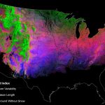
David Gudex-Cross and Likai Zhu are developing new satellite-based indices of snow and frozen ground dynamics for winter biodiversity assessments and other conservation applications.

  • Previous page
  • 1
  • You're on page 2
  • 3
  • 4
  • 15
  • Next page
University logo that links to main university website

Contact Us

  • Dept of Forest & Wildlife Ecology
    Russell Laboratories
    1630 Linden Drive
    Madison, WI 53706
  • Map map marker
  • Email: helmers@wisc.edu
  • Phone: (608) 890-3160

Website feedback, questions or accessibility issues: helmers@wisc.edu.

This site was built using the UW Theme. © 2025 Board of Regents of the University of Wisconsin System.

Login Request Help Help Docs